BOOK LIBRARY · Complete books · Purchases disabled
TrendWindow

← Book Library · Complete book

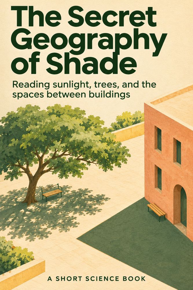
Front cover of The Secret Geography of Shade

Science, Technology & Nature

The Secret Geography of Shade

By TrendWindow Library

Why does a bench lose its shade without moving? Eight chapters follow two imagined benches through sunlight, simple geometry, trees, stored heat and careful observation to explain what a shade map can actually tell us.

Read this complete edition, including its ending and notes. No purchase is required.

About this book

### Reading sunlight, trees, and the spaces between buildings

A complete short science book in eight chapters. The square, benches, observations, and decisions used as examples are invented for explanation. They are not field measurements. The numerical shadow examples are calculations under stated assumptions. Sources support the physical principles; they do not certify the imaginary square.

Original complete short science book prepared with AI assistance. The square, records and decisions are labelled imagined examples; numerical shadow lengths are calculations under stated assumptions, not field measurements. This is not a site survey, professional design assessment or heat-safety certification. Translations reviewed with AI without independent native-language certification.

1. The bench that changes its address

A bench does not move, yet its place in the shade can disappear. At one hour its seat lies behind the edge of a building. Later, a bright strip crosses the same wood. A map that labels the bench simply “shaded” has left out the part of its address that changes: time.

Begin with an invented square. Bench A stands near a building. Bench B sits beneath a tree. A public path connects them to a drinking-water point. We will use these ordinary features to ask a precise question: where can someone find shade at the time they actually use the square? We will not assume that the darkest-looking place is the coolest, or that any patch of shade can be reached by everyone.

Shade begins when an object blocks direct sunlight from reaching another place. It is a relationship between a source, an obstruction, and a receiving surface. Move any part of that relationship and the boundary may move. Even when the bench and building remain fixed, the Sun's apparent position changes through the day as Earth rotates. Earth's tilted axis also changes the seasonal pattern of sunlight. [S1]

The phrase “the Sun moves” will be used here for what an observer sees across the sky. It does not mean that the Sun circles the square. This distinction lets us use everyday language without losing the physical explanation.

A useful first observation needs no equipment beyond a notebook. Identify the object blocking the light, the surface receiving its shadow, and the time. Looking at the ground is sufficient. Do not look directly at the Sun or point binoculars or a telescope at it for these activities. NASA's solar-viewing guidance explains why direct viewing requires specialized protection; this book's observations do not require direct viewing at all. [S7]

Bench A therefore has more than a location. It has a changing relationship with the sky and its surroundings. To understand that relationship we need a little geometry, but not a street full of instruments. A simple triangle can reveal both how much a model explains and where it stops.

2. A triangle on the pavement

Picture a vertical pole on level ground, illuminated by direct rays from a Sun above the horizon. Ignore other obstructions. The pole's height, the ground shadow, and a ray from the pole's top form a right triangle. Let h be the height, L the shadow length, and alpha the Sun's elevation above the horizontal.

In that idealized model, tan(alpha) = h/L, so L = h/tan(alpha). This is a derivation from the triangle, not a measurement taken in our square. The angle is measured from the horizon, not from the vertical. Confusing those two angles reverses the lesson.

For a two-metre pole, an elevation of 30 degrees gives about 3.46 metres of shadow. At 45 degrees the shadow is 2.00 metres. At 60 degrees it is about 1.15 metres. These calculated values show why a higher Sun gives a shorter shadow for the same vertical object and level surface. They are not predictions for nine, twelve, and three o'clock.

An angle alone does not tell us the shadow's compass direction. Elevation describes how high the Sun appears. Azimuth describes its direction around the horizon. The shadow of our simple pole extends away from the Sun's horizontal direction. A high Sun and a low Sun could share an azimuth yet produce very different lengths.

NOAA's solar-position equations make clear that location, date, time, and the conversion between clock time and solar time matter. [S2] Writing “noon” on a sketch without identifying which kind of noon can conceal an error. Solar noon is not necessarily twelve on a local clock.

The triangle is useful because its assumptions are visible. A leaning pole changes it. A slope changes the receiving surface. Another building may intercept the light before it reaches the pole. A broad crown is not a thin pole. Close to the horizon, the ideal formula produces very long lengths, while the real horizon and intervening obstacles become especially important.

Do not discard the model because it has limits. Use it to ask a better question: which assumption fails here? The answer will often explain why a real shadow does not resemble the neat line in a notebook.

3. A street is not a single pole

Replace the pole with a building. Its roof has several edges, its façade may step back, and a neighboring structure may block the same light. A point on the ground is shaded when an obstruction lies between that point and the direct sunlight. The outline of a building on a map does not, by itself, tell us the outline of its shadow.

The useful question is local: which obstruction matters for this point at this time? In our invented square, the corner of Bench A nearest the wall could lose shade before the far corner does. “The bench is shaded” may describe one end, the whole seat, or merely a photograph taken from a flattering angle. A good note specifies the part being discussed.

Street orientation matters because the Sun's direction changes the angle at which light enters the space between buildings. Height and separation matter as well. These relationships are geometrical; they do not require assuming that every north-facing side, in every place and season, behaves the same way.

The EPA also describes how urban geometry affects airflow and the absorption and release of energy. [S5] That is a reason not to treat a narrow shaded street as a complete explanation of thermal conditions. A shape can block a direct beam while participating in other exchanges that a shadow outline does not record.

Try a modest indoor model if the distinction remains elusive. Place two small cardboard boxes on a table and illuminate them with a cool LED flashlight. Keep the boxes fixed while moving the light. Then keep the light fixed and change the gap. Watch the boundaries on the table, not the light source.

This is an illustration of obstruction, not a calibrated model of a city. A nearby flashlight sends rays in directions that are less nearly parallel than sunlight at street scale. It can show a principle without reproducing the exact proportions of outdoor shadows. Record that difference if you draw conclusions from it.

We can now improve Bench A's label: “the western half of the seat was in direct shade at the recorded time.” That sentence is less grand than “a shady square.” It is also much more useful to someone deciding where to sit.

4. What passes through a tree

Bench B has a different overhead neighbor. A tree crown contains leaves, branches, and gaps. Its pattern can change as leaves move. Shade beneath it may be interrupted by bright patches rather than bounded by one straight edge.

Blocking the direct beam does not remove every route by which light arrives. The Department of Energy distinguishes direct sunlight from diffuse light scattered in the atmosphere. [S3] Light can also reach a place after reflection from surrounding surfaces. That is why a shaded page can remain readable. “No direct sunlight at this point” is a more precise statement than “no sunlight.”

For our example notebook, define three categories. “Direct shade” means that the observed point has no direct sun at that instant. “Sun” means direct sun is present there. “Mixed or changing” means patches or movement make a single label misleading during the short observation. These are working definitions for this book, not an official classification standard.

The definitions prevent a small deception. A photograph may catch a leaf over the point just when the shutter opens. A person sitting for several minutes experiences a sequence. If the question concerns a ten-minute rest, a single instant cannot establish that the whole rest will remain shaded.

Trees also interact with heat in a way a simple opaque roof does not reproduce. The EPA identifies shading and evapotranspiration as distinct cooling mechanisms: water movement through vegetation and evaporation from vegetation and soil participate in cooling. [S4] This does not yield a fixed cooling value for any tree we happen to find.

Species, leaf cover, water availability, weather, and surrounding surfaces make blanket comparisons unhelpful. We have not measured those conditions in the imaginary square. Therefore we will not promise a temperature reduction merely because Bench B has a green canopy in the drawing.

The difference between the benches is now richer than building versus tree. One may have a more sharply defined moving edge; the other may have a changing pattern overhead. The question becomes how each pattern serves a person over a particular interval, rather than which symbol looks greener on a map.

5. Three meanings of cooler

Suppose someone places a thermometer on the sunlit seat of Bench A and then carries it beneath the tree. A lower reading might look like a quick answer to our question. But what did the instrument measure, and what changed while it was moved?

Air temperature, surface temperature, and a person's experience of heat are not interchangeable. The EPA distinguishes surface and atmospheric heat islands. [S5] A surface can have a different temperature from the air above it. The amount of direct radiation reaching a person can change even when the surrounding air has not instantly changed by the same amount.

NIST explains why air-temperature instruments are shielded from radiation while allowing airflow. Direct heating of the instrument interferes with measuring the air itself. [S6] Simply placing an unshielded sensor in sun and then in shade does not produce a clean measurement of the difference between the two air temperatures.

A surface measurement answers another question. If an instrument is designed to measure a surface, record which surface and follow its instructions. A number for a wooden seat is not automatically a number for nearby paving, and neither is an air reading. There is no benefit in giving several different quantities the same label.

Time matters here too. A newly shaded surface does not have to lose its stored heat immediately. Urban materials can store energy and release it later; the EPA's discussion of heat islands includes that delayed release. [S5] A shadow edge crossing the seat is an observable event. It is not a command that instantly resets every temperature.

Our notebook will therefore separate what we know. We can record a shade boundary without recording any temperature. If we later add temperature observations, we must identify the instrument, quantity, placement, time, and limitations. A personal note such as “this felt more comfortable to me” remains a personal report, not a calibrated environmental measurement.

This book is about reading shade, not certifying a place safe during heat. An apparently inviting patch does not replace local heat guidance or a person's own needs. The immediate scientific gain is simpler: we stop asking one observation to answer three different questions.

6. A notebook with honest gaps

Let us build an illustrative record for the square. The following entries are invented to demonstrate notation, not observations made by the author. At 09:30, Bench A's whole seat is marked direct shade. At 12:30, its seat is marked sun. At 15:30, it is marked sun again. Bench B is marked mixed or changing at each of those three visits.

What does this record establish within the example? It gives three snapshots. It does not tell us the exact moment Bench A lost shade. It does not prove that Bench B's pattern stayed constant between visits. The same label can conceal changes in the size and position of bright patches.

Now add ten fixed observation points along the public path. At the first visit, six points are in direct shade, three in sun, and one mixed. Six out of ten is 60 percent of the sampled points. It is not automatically 60 percent of the path's length, width, area, or walking time. A sampling method must justify a larger claim before we make it.

After the benches have been recorded on the second visit, a cloud covers the square. We leave the obstruction-based path classification unresolved and record the cloud. We do not enter zero shade just because the boundaries are hard to identify. Missing information and a measured zero are different entries.

A reusable page needs a date, local clock time and time zone, a simple location sketch, fixed labels for the points, cloud and wind notes, the category definitions, and space for uncertainty. Add the observer's position when photographs are used. Avoid including identifiable strangers when the aim is to document a boundary.

Repeat a visit using the same points. Keep a change in method visible rather than quietly replacing the earlier record. If a bench is moved, a tree loses leaves, or access is blocked, note that the comparison has changed. Do not silently force unlike visits into a tidy trend.

A notebook becomes trustworthy through these modest distinctions. Its value is not the number of filled boxes. It is the ability of another reader to tell what was seen, what was inferred, and what was not established.

7. A season changes the question

A map from one afternoon is not a map for the year. Earth's axial tilt changes the seasonal path of sunlight; the two hemispheres have opposite seasonal timing. [S1] A tree may also change its leaf cover, depending on its species and conditions. Building geometry may remain fixed while its relationship to incoming light changes.

Avoid a universal compass rule. “The noon shadow points north” is not true for every latitude and date. In tropical locations the noon Sun can lie on different sides of the observer during the year. A local observation deserves a local explanation.

Nor should “summer” be used as though it names the same months everywhere. Record a date and place before applying a seasonal comparison. Our pole calculation used three chosen elevations, not three dates. To turn it into a prediction for a real place would require additional astronomical and site information.

A digital solar tool can help explore geometry, but its inputs and maintenance matter. NOAA's calculator page currently states that the tool is no longer actively maintained. We used its published equations as background and did not obtain field observations from it. [S2] A computed Sun position is also not a complete model of every branch and building around a bench.

There is a second seasonal question: whose visit matters? A school pickup, a midday lunch, and an evening walk concern different intervals. A place with the most shade over a whole day may still be sunny when someone needs it. This is a question for a proposed survey, not a claim that we interviewed the imaginary square's users.

Before recommending a change, specify the intended use and the evidence still missing. A drawing of a new canopy is not proof of its performance, permission to install it, or a substitute for appropriate local design advice. Our small exercise ends at a reasoned observation plan.

The season therefore does more than change shadow length. It changes the question asked of the map. A useful map carries its date openly and leaves room for another one.

8. A map that knows its limits

Return to the two benches. We cannot honestly crown a universal winner. Our invented entries show Bench A shaded at one recorded time and sunlit at two others. Bench B has a mixed pattern at all three. We know neither continuous shade duration nor comparative air temperature. The unresolved cloudy path visit remains unresolved.

Yet the exercise has produced something better than the original label. We now have identifiable places, times, definitions, and questions. For a morning visit, the Bench A snapshot provides a reason to investigate that interval further. For a longer rest beneath the tree, the moving patches suggest recording a short sequence rather than relying on one photograph.

The next observation is concrete. Revisit the relevant bench over the intended interval, keep the same viewpoint and definitions, and note changes in cloud or access. Observe from a safe public place without blocking a path or entering a road to chase a shadow. If conditions are unsuitable, leave a gap and return another time. The gap does not spoil the method.

We also know what not to infer. Darker is not automatically a measured temperature. Agreement among several photographs is not proof of year-round performance. A shaded patch behind an inaccessible barrier does not become useful simply because it appears on the map.

The science and the human question now fit together. Geometry helps explain where a boundary falls. Light arriving by different routes explains why shade is not total darkness. Vegetation and thermal storage explain why a shadow alone cannot tell the whole heat story. Careful notation explains what our evidence can support.

Our imagined map receives its final title: “Shade observations at selected places and times.” Beneath it we write the date, the definitions, and the unresolved questions. We have not discovered a permanent secret location. We have learned to read a changing relationship.

That is the ending of this short journey. The bench remains where it was. The light will change again. What has changed in us is the habit of asking when, where, by what mechanism, and on what evidence—questions that turn an attractive patch of shade into something we can understand without pretending to know more than we do.

### Sources and scope
Research checked 9 November 2026. All square records are invented demonstrations. Pole-shadow lengths are independently calculated from the stated triangle. No live site survey, temperature campaign, professional design assessment, or medical certification was performed.

[S1] NASA Space Place, [What Causes the Seasons?](https://spaceplace.nasa.gov/seasons/en/).
[S2] NOAA, [General Solar Position Calculations](https://gml.noaa.gov/grad/solcalc/solareqns.PDF), and the maintenance notice on the [Solar Calculator](https://gml.noaa.gov/grad/solcalc/).
[S3] U.S. Department of Energy, [Solar Radiation Basics](https://www.energy.gov/cmei/systems/solar-radiation-basics), direct and diffuse radiation.
[S4] U.S. EPA, [Benefits of Trees and Vegetation](https://www.epa.gov/heatislands/benefits-trees-and-vegetation), shading and evapotranspiration.
[S5] U.S. EPA, [What Are Heat Islands?](https://www.epa.gov/heatislands/what-are-heat-islands), geometry, heat storage, and surface versus atmospheric temperatures.
[S6] NIST, [How Do You Measure Air Temperature Accurately?](https://www.nist.gov/how-do-you-measure-it/how-do-you-measure-air-temperature-accurately).
[S7] NASA, [Eclipse Viewing Safety](https://science.nasa.gov/eclipses/safety/), direct solar-viewing hazards; our observation method looks at shadows.
Explore more books →